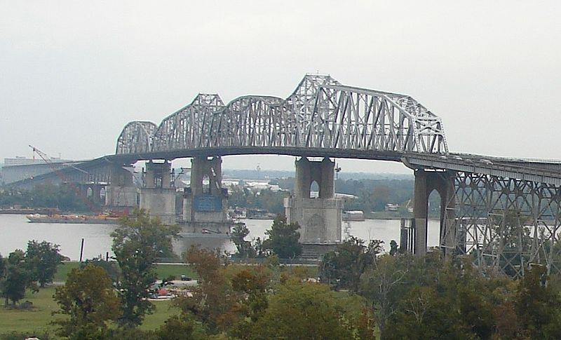
Some family members have a trip on the Crescent and the Sunset Limited next month. Which of these cross the Mississippi? Where? On the Huey P. Long bridge? We're concerned about the river flooding.
Thanks,
John Bobinyec
Thanks,
John Bobinyec


The Crescent does not cross the Mississippi. Sunset crosses the Mississippi on the Huey P. Long Bridge. But more importantly, the Sunset crosses the Atchafalaya River and Basin on a long trestle/causway and that Basin is likely to flood if the Morganza Spillway is opened to relieve pressure on the area downriver, i.e. Baton Rouge and New Orleans. But hoopefully all this be a thing of the past by the next month.Some family members have a trip on the Crescent and the Sunset Limited next month. Which of these cross the Mississippi? Where? On the Huey P. Long bridge? We're concerned about the river flooding.
Thanks,
John Bobinyec
Some family members have a trip on the Crescent and the Sunset Limited next month. Which of these cross the Mississippi? Where? On the Huey P. Long bridge? We're concerned about the river flooding.
Not correct.The Crescent crosses the river by going over Lake Ponchartrain. The Sunset Limited doesn't cross the Mississippi. It goes west to New Iberia before heading for Lafayette.Some family members have a trip on the Crescent and the Sunset Limited next month. Which of these cross the Mississippi? Where? On the Huey P. Long bridge? We're concerned about the river flooding.
Any Sunset suspension will not be due to flooding at the Mississippi Channel by Huey P. Long Bridge. If at all there is any suspension (though unlikely) it will be due to flooding in the Atchafalaya Basin way west of New Orleans.If the Huey P. Long bridge goes under the whole world will be flooded. It's hundreds of feet above the Mississippi. :giggle: Will be interesting to see if they have to suspend service on the Sunset route because of the flooding. If they suspend it....will it ever be restored or will it just disapear like the service to Florida after Katrina?
I've spent a good portion of my morning reading about this - fascinating stuff! I read a book (fiction) whose plotline revolved around someone purposefully redirecting the Mississippi into the Atchafalaya for profit, but had no idea how grounded in reality it was.If at all there is any suspension (though unlikely) it will be due to flooding in the Atchafalaya Basin way west of New Orleans.
I have too. Despite reading the Washington Post article yesterday (I think it was yesterday), I saw no mention of the possibility that these floods could actually move (permanently) the main channel of the Mississippi to the Achafalaya River. So I was a bit surprised to read about that this morning on the internet. This apparently almost happened during the 1973 floods. And it will likely happen if the Army Corps of Engineers loses control of the river at the Old River Control Station.I've spent a good portion of my morning reading about this - fascinating stuff! I read a book (fiction) whose plotline revolved around someone purposefully redirecting the Mississippi into the Atchafalaya for profit, but had no idea how grounded in reality it was.If at all there is any suspension (though unlikely) it will be due to flooding in the Atchafalaya Basin way west of New Orleans.
The Sunset route from Lafayette passes way to the south. I would think the long 20 mile I10 bridge east of Lafayette would be more the target.Any Sunset suspension will not be due to flooding at the Mississippi Channel by Huey P. Long Bridge. If at all there is any suspension (though unlikely) it will be due to flooding in the Atchafalaya Basin way west of New Orleans.If the Huey P. Long bridge goes under the whole world will be flooded. It's hundreds of feet above the Mississippi. :giggle: Will be interesting to see if they have to suspend service on the Sunset route because of the flooding. If they suspend it....will it ever be restored or will it just disapear like the service to Florida after Katrina?
I agree with your assessment and I think henryj needs to look at a topo and flood level projection map to understand the situation as it will develop around Morgan City. A 15' flood level will easily put the track at least 5' under if not more.But the MS River posses no thread to the Sunset Limited. However, as mentioned, the Atchafalaya basin does. The Sunset Limited reaches the basin about 2 hours after departure when it passes Morgan City. The basin is about 20 miles wide and tracks are all at grade here except for where they a cross a small water way.
With the opening of the Morganza Spillway this weekend, the basin could see flooding anywhere from 5-20' of water. So there's a very high chance BNSF's tracks are gonna get submerged (and possibly for a while), suspending the Sunset Limited and freight.
the Sunset Limited has a high chance of a service disruption about 3 days after the Morganza spillway opens and water first reaches that area.
Pat, did you have geography when you were in school?
[\quote]
I sorry. Yes, I did study geography, but evidently I had my terminals crossed. It's the cruise terminal that is south of the Mississippi. I had it mixed up with the train station. Therefore, I had it all backwards as usual!
Look at the two links posted by tracktwentynine further up this thread.You are right, I do not have topo maps or anything else to make an assessment. The Sunset route was built in the 1880's so I just assume they went way south via Morgan City to avoid the swamps and flooding east of Lafayette. If the track is going under so will Morgan City and everything else around there. What other cities will be inundated? Anyone have any idea. What about the old MP route that goes north of Lafayette and into Baton Rouge?
Opening the spillway had been a foregone conclusion for the past week, but the corps reduced the amount of water it planned to divert into the spillway by nearly 60 percent, to about 125,000 cubic feet per second.
That’s less than a quarter of the control structure’s maximum capacity of 600,000 cubic feet per second, which could be a bit of good news for people with property in the floodway.
. . . .
The decision to open the spillway was triggered when the river’s flow rate reached 1.5 million cubic feet per second, and still rising, at Red River Landing across from the State Penitentiary at Angola.


Hard to say. The corps has estimated that the flooded areas could take 30-60 days or more to fully empty (trying to find the article I saw this in), again depending on how much water comes through the spillway and how long it remains opened.do you think that the Sunset will be up and running normally again by the first week of June?
Enter your email address to join: